About
Water Leak & Water Shortage
This Information system monitoring the complaint related to waterLeak and shortage using realtime datastore in a time frame manner

About
JJM
This Information system used to combining assets with jjm pipelines data driven from kobocollect app. Also provide the usablity of filter to view particular data(pipeline scheme) in map and as tables based on user selection through this geospatial portal.

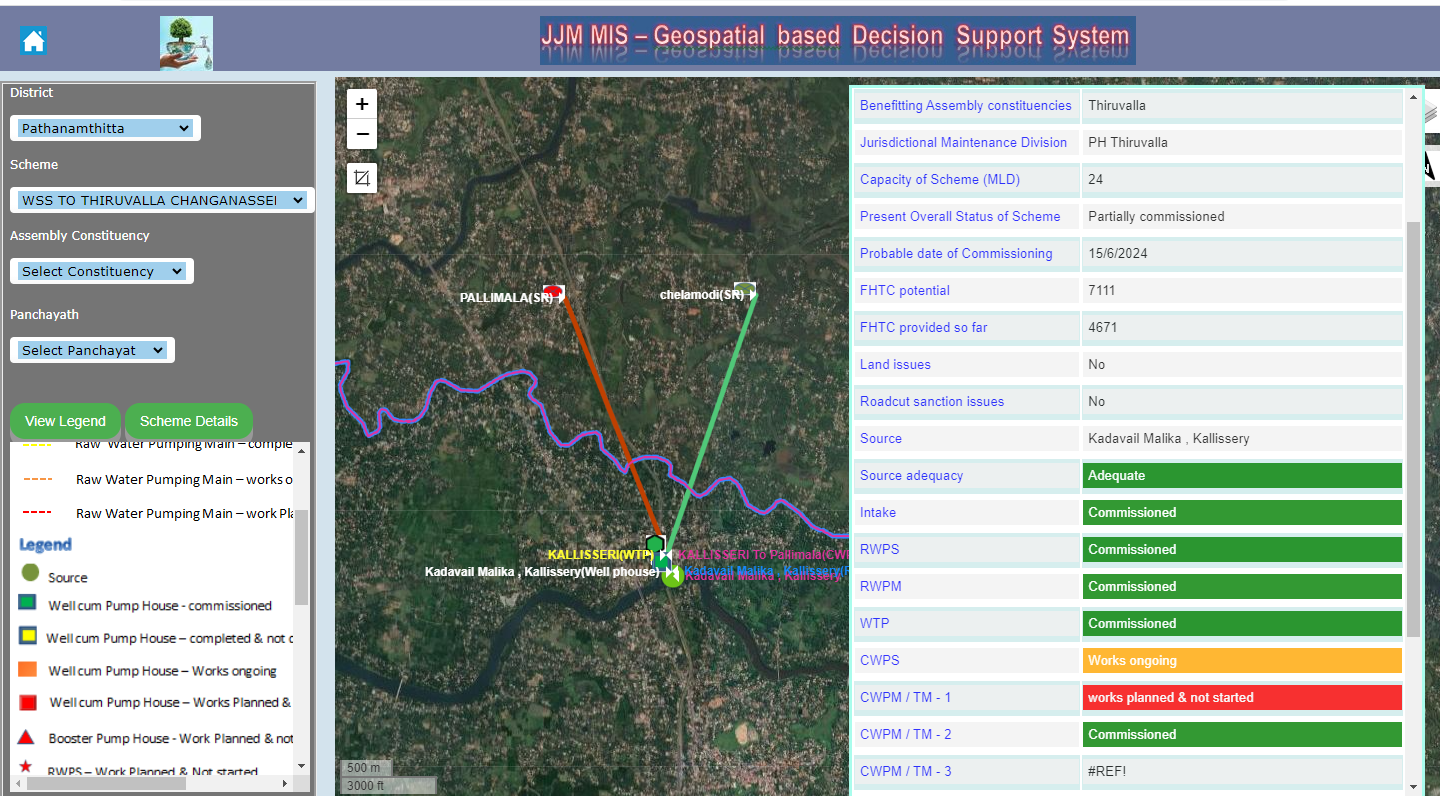
About
JJM DSS
This Information system used to combining assets with jjm in base map with scheme wise. There is a provision for edit the geolocation of point data and related values. Also help the view of all components schemewise selection by the admin or user for take the decision through this geospatial portal.
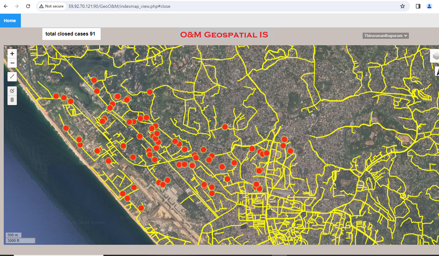
About
Geo-O&M
This Information system used to integrating O&M API data with geospatially. This informs us where is pipeline leak closed work done. It shows the geotagged image in popup of each geolocations and also datewise search is possible.Two level services- Public & Administrative level